Baildon Bank
This is the closest open space to where I live. Because of its topography it is not an easy place to pinpoint on a map. On the O.S 1:50,000 map it is shown but you need a keen eye to spot it and there isn't room enough for its name to be shown. Another drawback is that Baildon is annoyingly on the main fold of the map!
If you happen to have the Bradford Street Atlas turn to page 17,square G2. You will see that the bottom of the Bank is bounded to the south by Green Rd; Midgeley Wood marks its westerly extremity and the perimeter fence at the back of Sandal's School (previously known as Belmont Middle School) forms part of the northern boundary. Bank Walk at its north eastern edge provides the nearest access from the village centre.
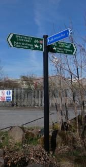 Gomersal lies at around 140 metres (450 ft) above sea level on a flank of the Spen Valley and has fine views over to the Pennine hills. Prominent is West Nab (500 metres) which lies above Marsden and, to the left of West Nab, Black Hill which at 582 metres is the highest point in Cheshire and the highest on the Pennine Way for some miles to come.Whilst admiring this view today a bird flew low in front of me – hang on a minute, that wasn’t my first swa